Sherman Tanks of the US Army Official History books: This time the Pacific, so fewer photos, and a much different setting.
The third post in this series is going cover US Green cover book called the War Against Japan a Pictorial Record. This means there will be fewer Sherman shots and many more general shots than the last two.
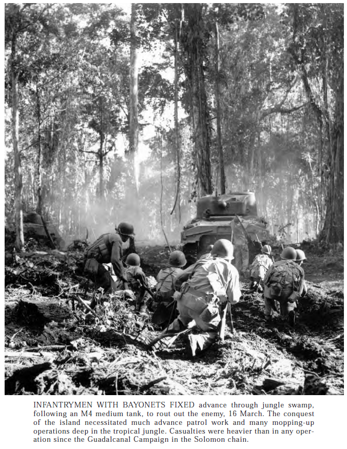
The images in this one are about the same quality as the last two, decent, but not great. Most were images I had not seen before though. The pictures show a very different type of war, the kind where you fight the terrain and environment almost as much as the enemy. The distances involved in the Pacific made everything, but supplying the troops specifically, much harder, and since the PTO was on a forced Shoe String Budget, sometimes they were forced to get creative with their resources. It also meant the Pacific was a much more intimate battlefield, the distances between battles was greater, but the fighting was often a very close affair, and small jungle trails in visibility of 50 yards or less. The Japanese were a brutal enemy, and many US soldiers feared capture by them, and would prefer death. Far few American POWs died in Nazi German hands than in Japanese hands, and the things the Japanese did to the Chinese rivals the crimes of Nazi Germany.
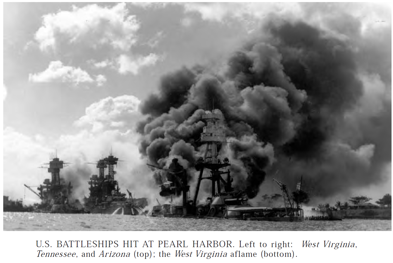
We have to start the pictures off with something, so how about a shot from Pearl Harbor, the attack has a personal connection. My grandfather was a Chief on the Tennessee. She suffered little damage in the attack, and after my Grandfather was transferred into a Destroyer Escort.
Right after Pearl Harbor, some light tanks saw use in the Philippines, before they were knocked out or ran out of fuel or spare parts. The Philippines Surrendered and there would not be much tank action until well into the Solomons and New Guinea Campaigns. Unfortunately, this book isn’t armor specific and doesn’t include any shots from these early armor actions.
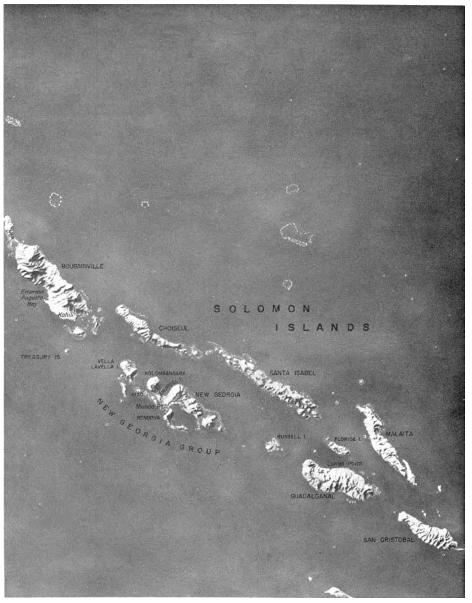
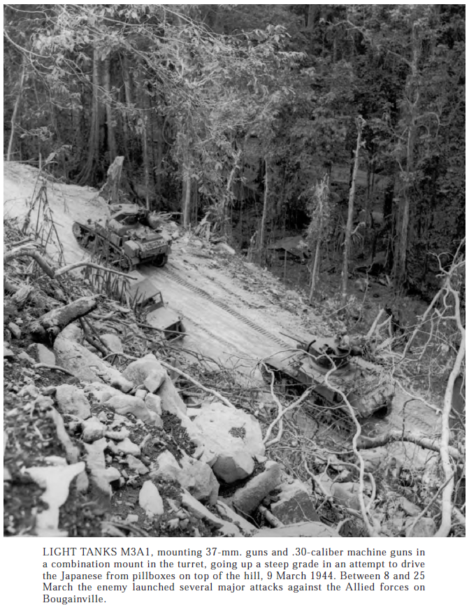
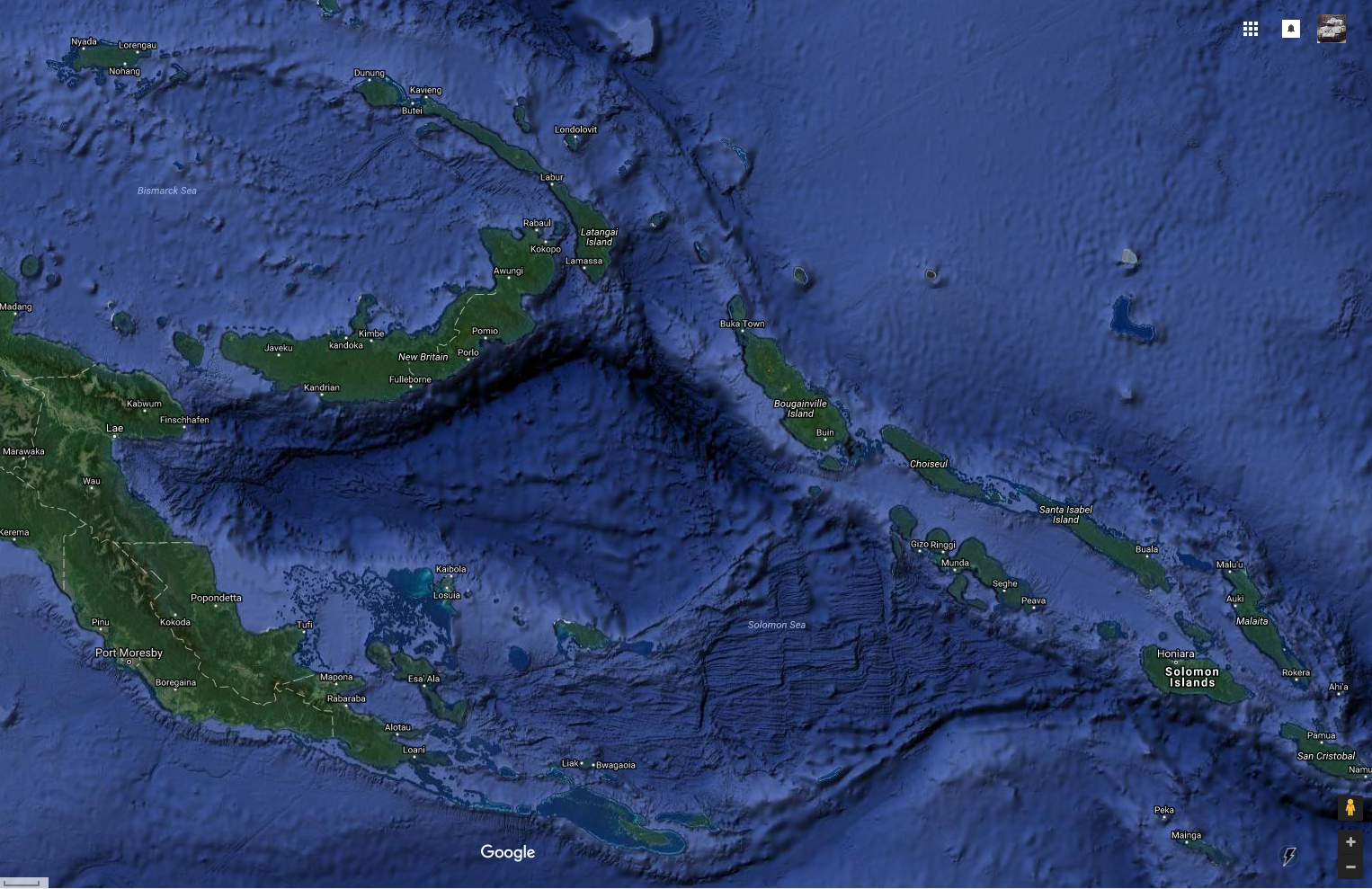
This is a map of the Solomon Islands, the location of several major and important battles. Most people if they know anything at all about the long campaign fought here, is the battle for Guadalcanal, the first battle in the series. It took place on the island in the lower right of the picture in 1942, and the final battles took place on the last Island, Bougainville, in 1944. This Campaign was a joint affair, with USMC, US Army, US Navy and units from the New Zealand and Australian militaries and Navies as well .During the Solomons campaign tanks saw limited use. The Marines used some M3 lights on Guadalcanal, and lights were the only tanks used until Bougainville, were Shermans were brought in.In this image, you can see a pair of Shermans working with GIs in the Jungles of Bougainville. It was the last Island in the Solomons chain the Allies would invade, and they just took a little chunk of it in the middle and built airstrips. These strips were used as forward refueling spots at first, letting aircraft going to Rabaul have longer loiter times. Eventually Marine Corsair squadrons and other fighter units moved in permanently.
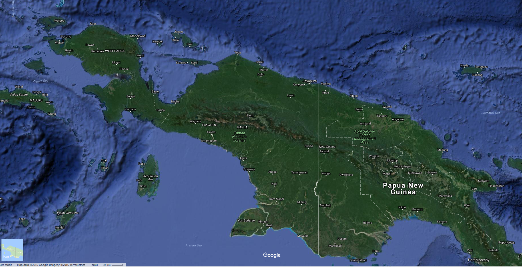
This is a map of new Guinea and New Britain, the location of the end of the solomons Campaign, and the location of another long Bloody campaign that was fought for the continent of New Guinea itself.
There were almost two separate wars going on, the US Navy with Admiral Chester Nimitz in charge of one side, and General Douglas MacArthur running the other half. New Guinea and New Britain was that half, and The solomons ended to the south west of New Ireland, and at the end of that campaign were bombing Rabaul, a huge Japanese base that dominated the area.
MacArthur’s war on New Guinea involved US Army, Australian ground forces and backed int he air by US and Australian Air Power. The New Guinea Campaign was a long brutal fight, on a shoestring, were air power made a massive difference, and the brilliant commander of the 5th Air Force came up with some innovative tricks to enhanced the usefulness of airpower to a land war. For more information on the Air War over New Guinea, the General in Charge George Kenney wrote a book, and you can download it here!
This is a really great read, covering just about the whole war, and with many intimate details you won’t get elsewhere.
Ok, I decided those maps were to terrible, not totally useless, but with a resource like Google Earth Available, I just can help but add some better maps here.
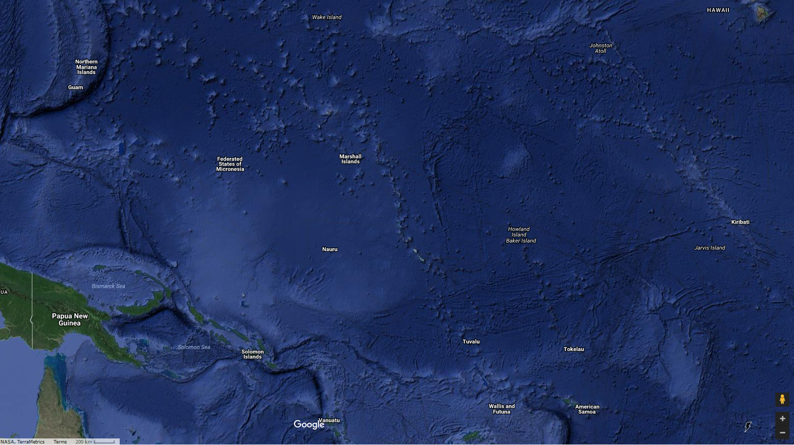
Click for a larger version. Note the scale in the lower left corner. Hawaii is in the right upper corner, and the northern most point in Australia is in the lower right. It shows about half of the New Guinea island/continent and should give an idea of how much distance was involved.Click for a larger version, the distance on the scale is 50 km, and this one is a close shot showing the whole Solomons chain, New Britain and about a third of New Guinea. Many of the airfields and bases can still be found on google maps, some still in use, many a minor scar in the jungle, and some are totally invisible.
Click for a larger version. This is the entire continent/Island of New Guinea. The scale on this one for the little key in bottom left is also 50 km.
The Japanese took most of the Island in the starting phase of the war, the Australians kept Port Moresby, and from there, the Allies, under MacArthur’s command started winning fights. The Stopped the Japanese in the Owen Stanley Mountains, preventing the fall of Port Moresby and they they started bombing the Japanese, and sinking there shipping.
They eventually went on the offensive, getting a small foothold on the Japanese north side of the Owen Stanleys, like a cancer in the Japanese forces colon, just kept grown, building a secret airfield in the interior, and then taking base after base from Japan, working their way west along the north coast of New Guinea. Then eventually heading north, on their own, smaller scale island hopping campaign up to the Philippines. These tropical Islands come very close to the equator, and were hot, wet, humid, jungle hells, with saltwater Crocodiles as the apex predator, if you didn’t take into account the natives, some still cannibals.
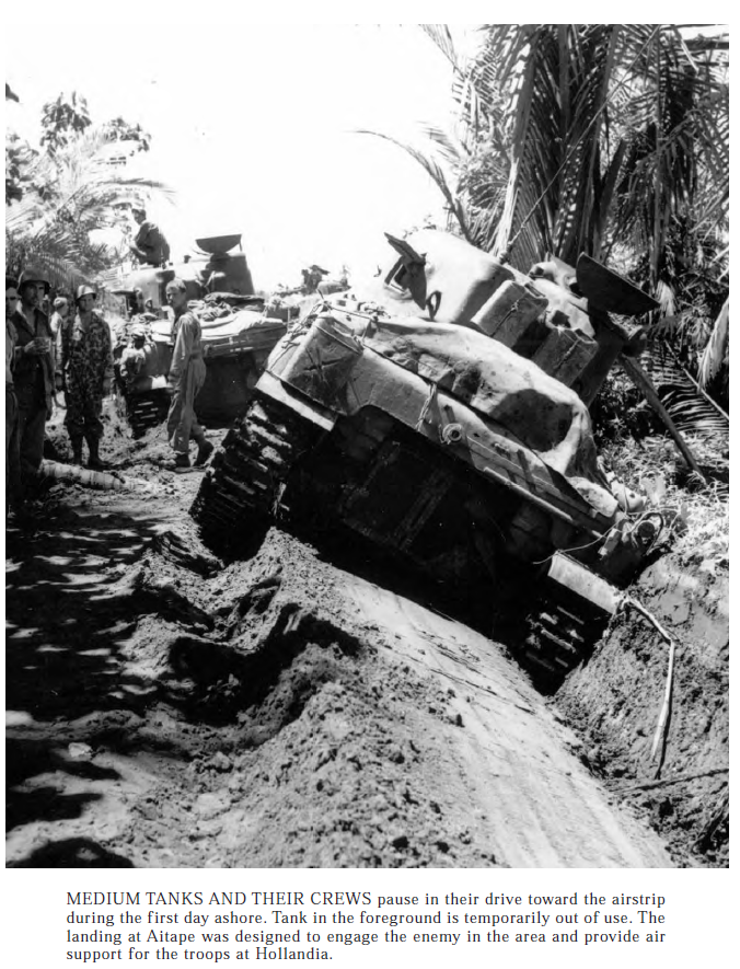
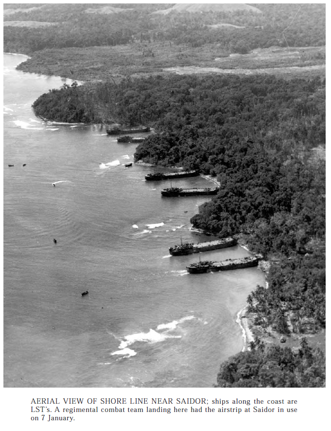
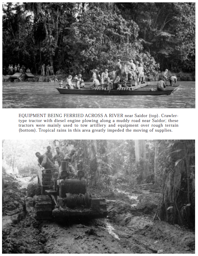
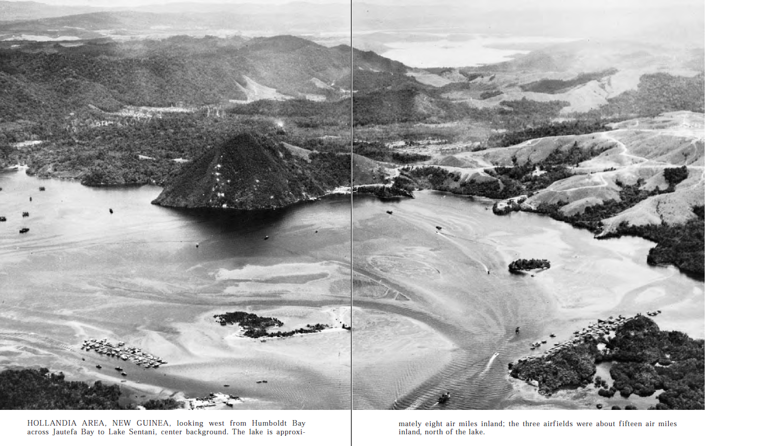
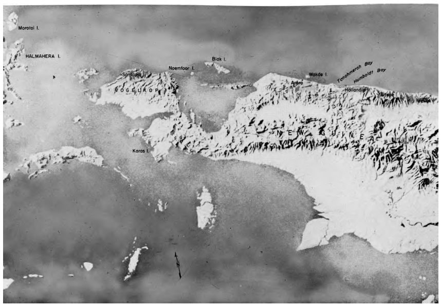
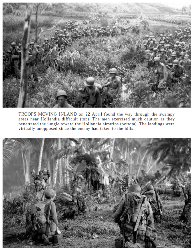
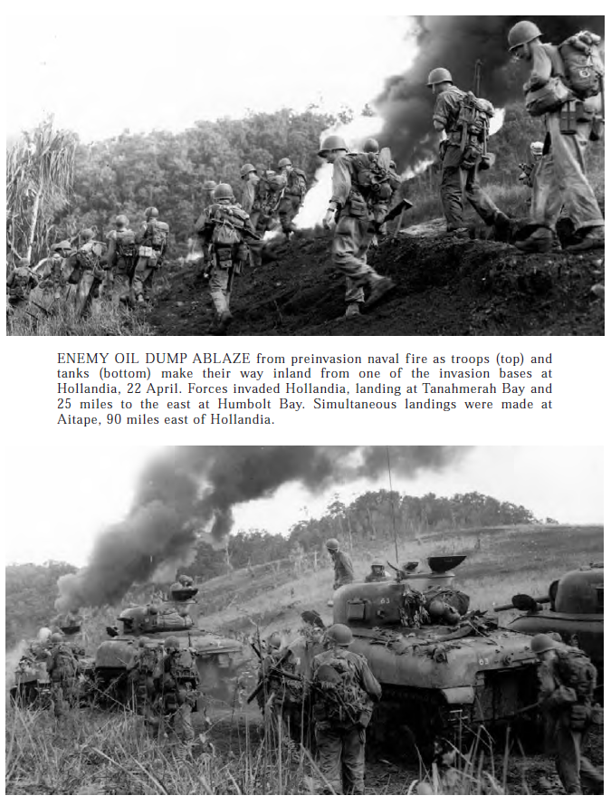
Aitape was another Allied strip installed in Norther New GuineaIf you look real close at the map above you can see Buna, and where this photo was taken.Finally some more Shermans right? These are M4A1s and they near Hollandia, currently Jayapura, the biggest town on the north coast, and the capital of the Dutch Colony before the Japanese took it all in 1942. They are was supposed to be very beautiful, if you could deal with the heat and bugs. Also, I bet that Sherman is not just stopped, bet it’s resting on it’s belly and the tracks were just churning the dirt.The Saidor landings were further east down the New Guinea coast, and earlier in the war. Looks like the Shore, at least in the tides pictured, were the perfect place for LSTs to pull right up to the shore.More GIs moving into to the Jungle near Saidor.Interesting shots of some equipment used at Saidor.A longshot of the Hollandia area, Hollandia is now Jayapura City the regional capital of Papua, Indonesia. Once this area was secure, the Allies built, or improved three airports, and MacArthur moved his HQ here until the fall of the Philippines.This is a map from the book, it’s still useful in placing stuff on the vastly better Google Earth map though. Getting accurate maps of the area was a problem during WWII and the allies often produced out own, using massive amounts of hi altitude aerial photos.More GIs moving inland to fight stubborn, but ill fed and ill equipped Japanese troops.
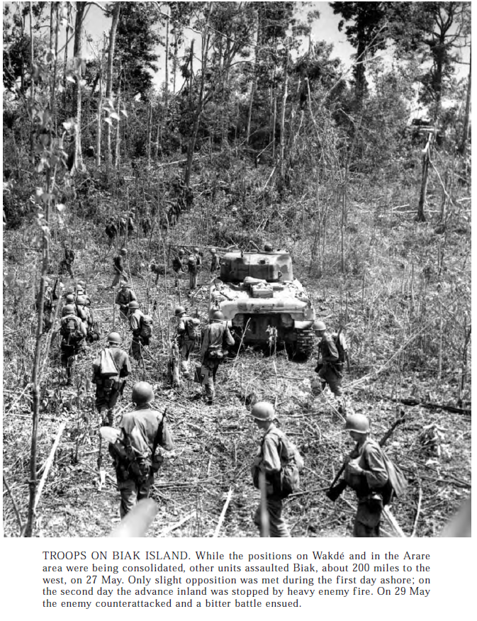
More shots from the Hollandia area. These Sherman tanks would be devastating opponents for the Japanese. Their AT guns were always in short supply, a their more suicidal methods, like charging the tank with the pole mine, or swarming onto it to place satchel charges on hatches or other weak spots. This image is no longer on New Guinea, its on a smaller island to the west named Biak Island then, Pulau Supiori now. Once this island was secure we built more airfields so long range bombers and P-38 fighters could rome ever closer to Japan looking for things to shoot down or bomb.
The Marshalls campaign starts here.
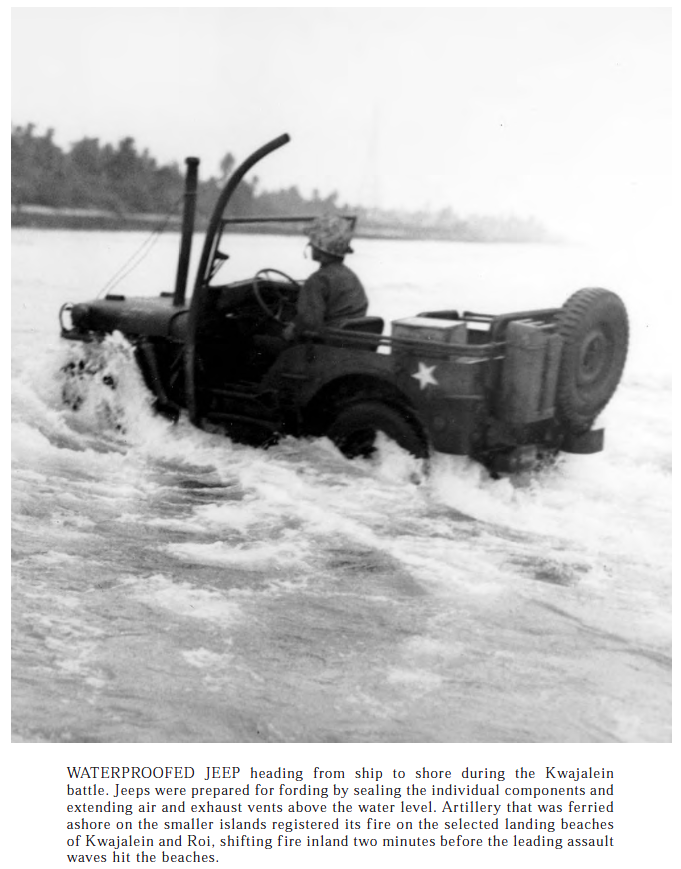
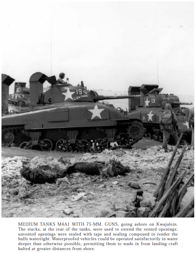
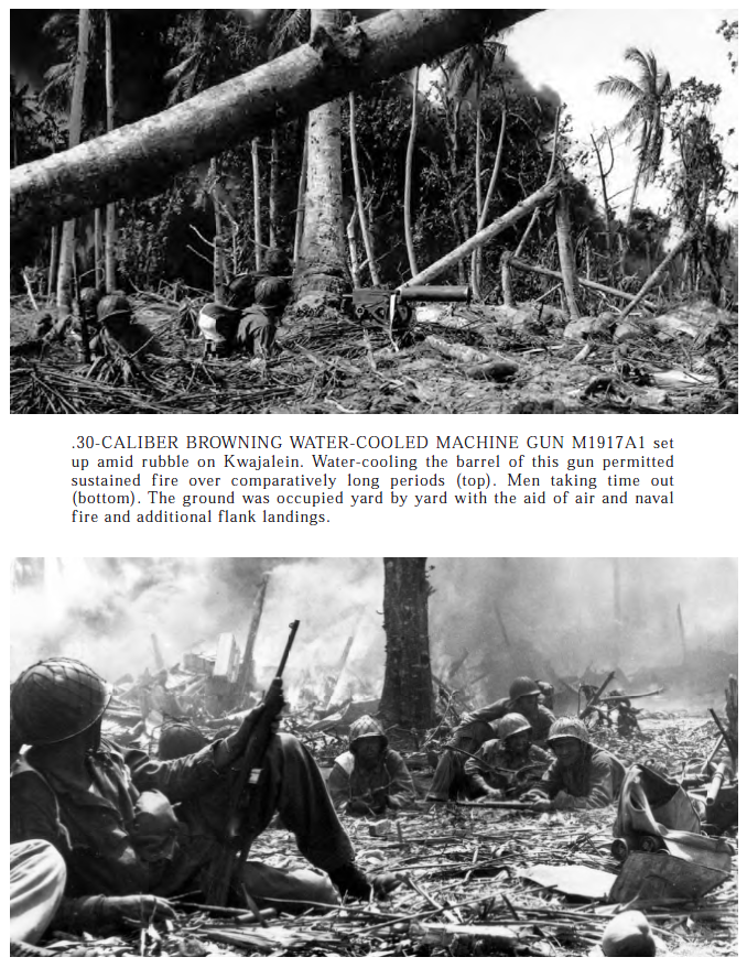
Click to enlarge, the Marshals are on the right, the map doesn’t have them centered because I wanted to get the Solomons into the same map.The Marshalls are a series of small islands north east of the Solomons. The Japanese strong points there had to be knocked out.Who doesn’t want a nice waterproof Jeep?This post is getting bigger and bigger, and I’m sure I can find out what tank Battalion was on Kwajalein.. These are late production small hatch M4A1 75 tanks.This kind of tank infantry work required close cooperation, and you can see in the image the line of infantry is in front of the tank. The tank is an M4A1 75 the remains of the wading trunk is still in place. maybe one of the one from the previous picture.
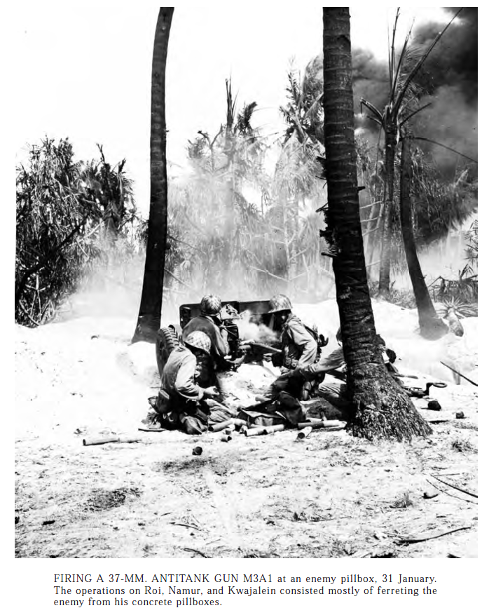
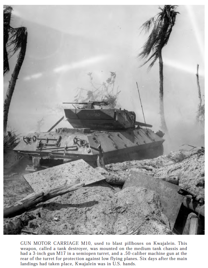
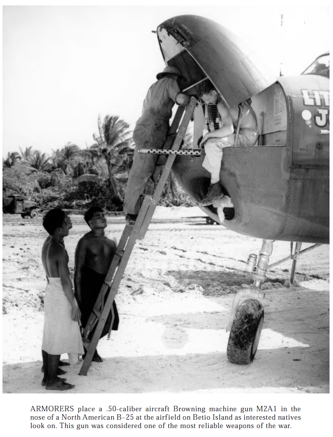
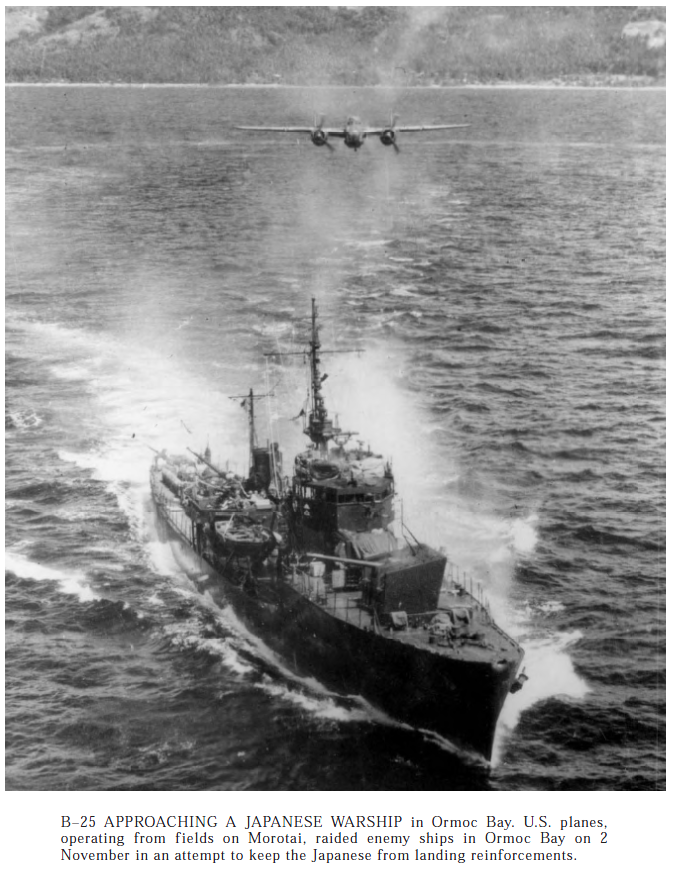
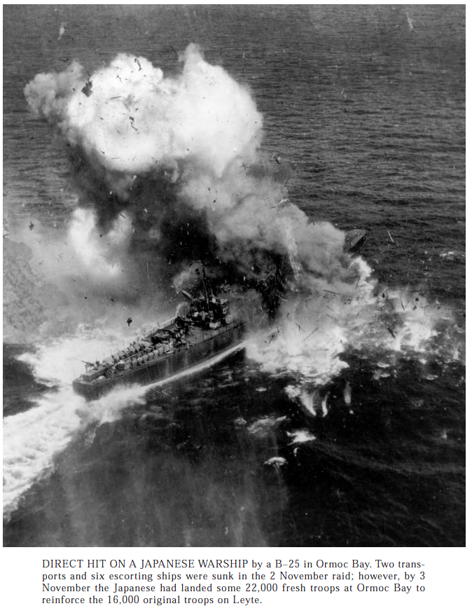
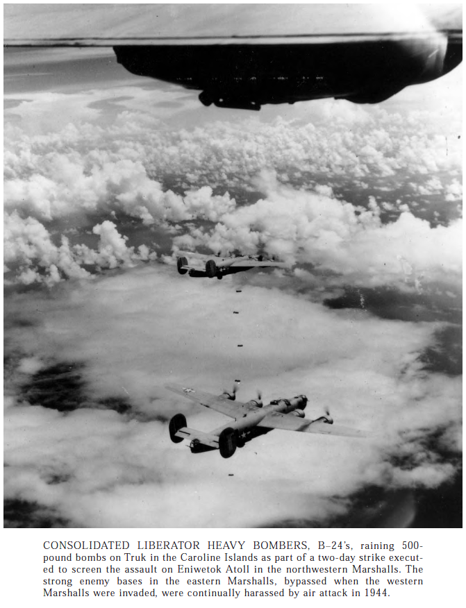
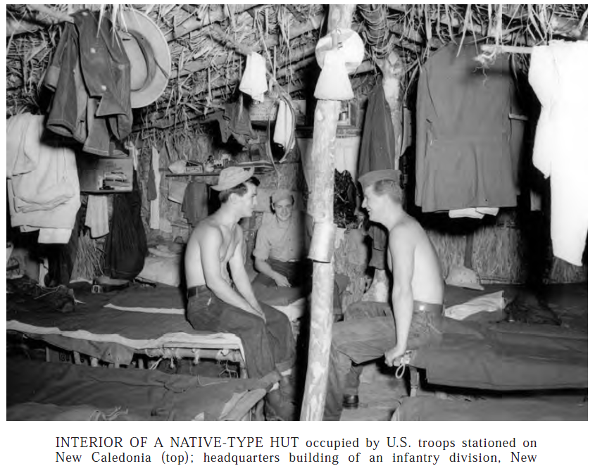
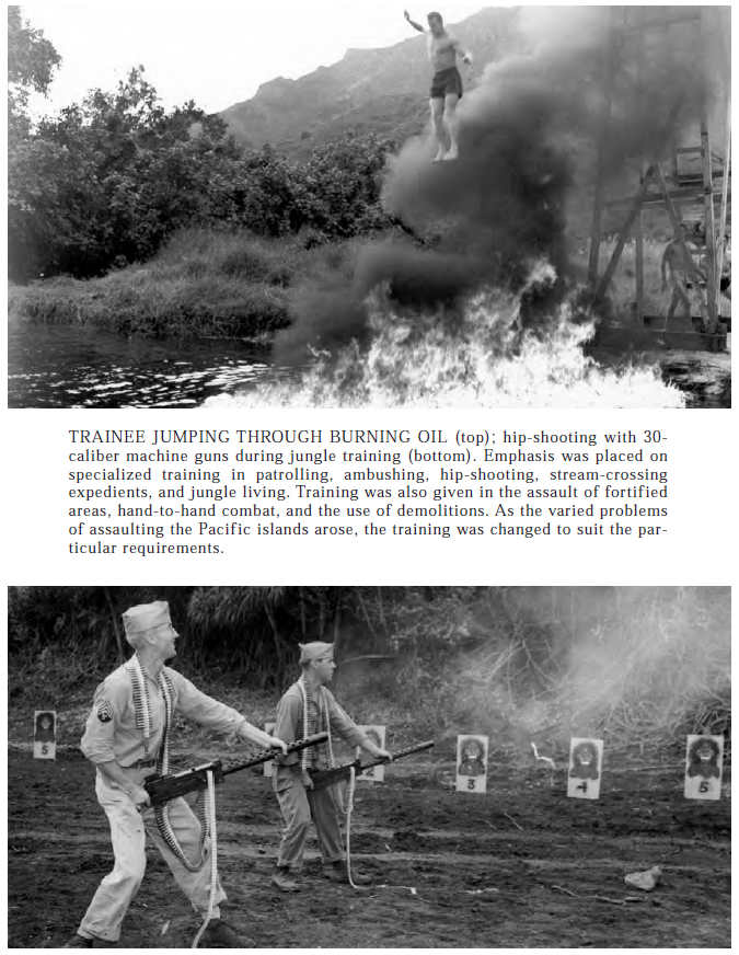
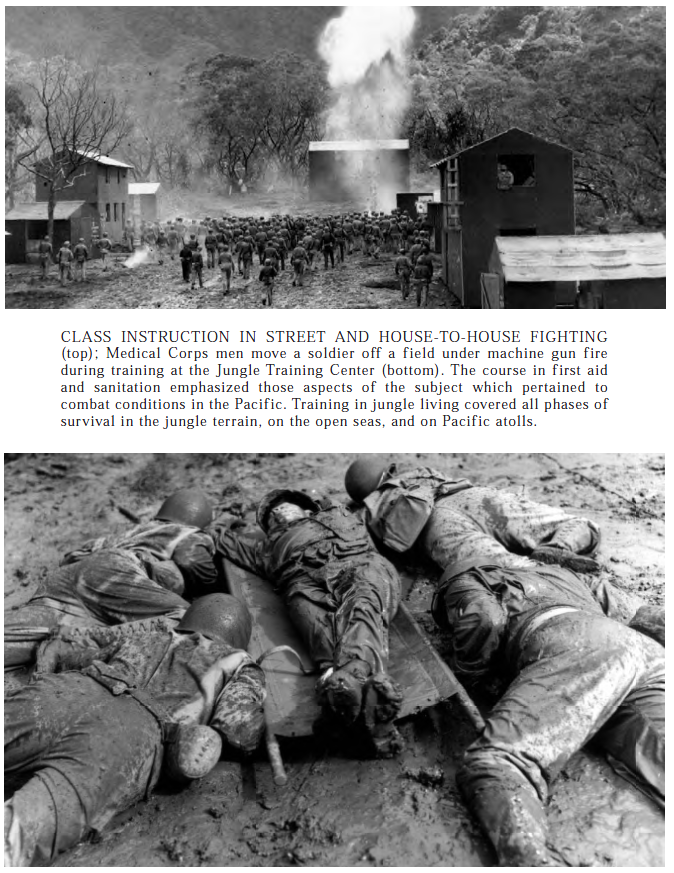
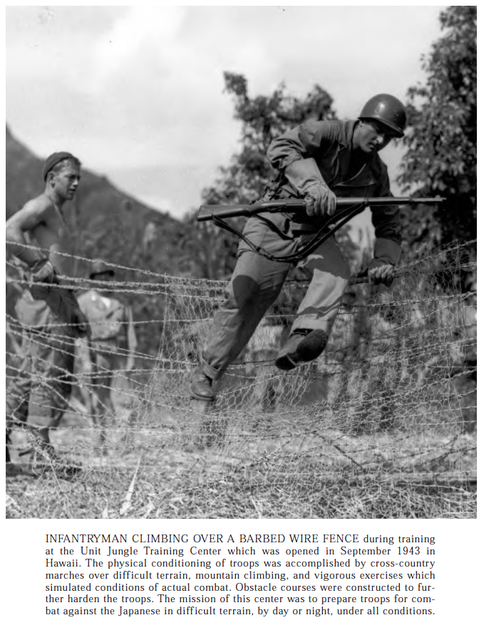
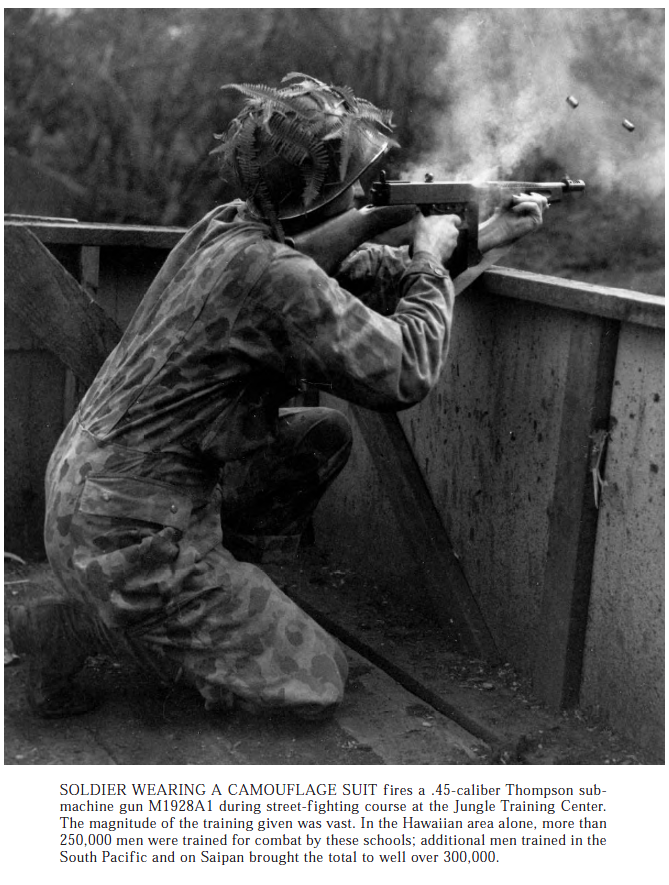
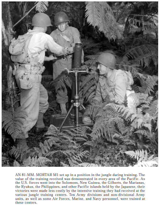
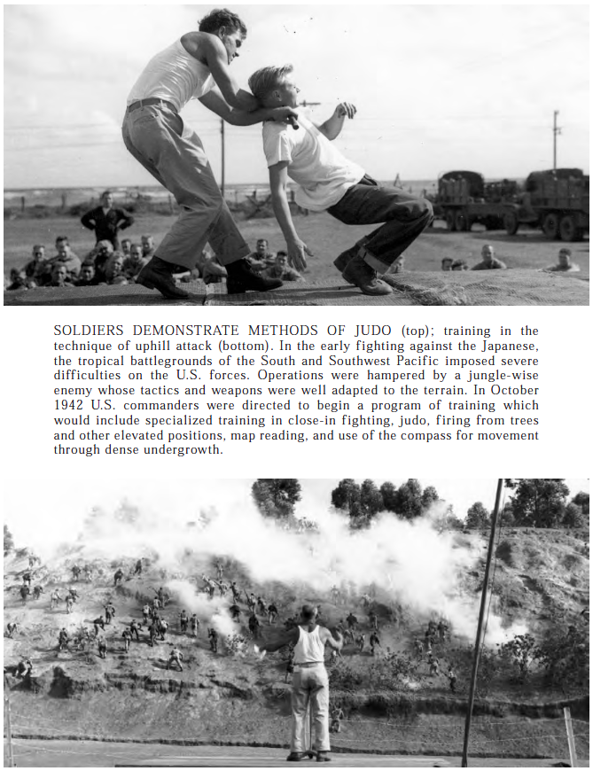
M10 GMC and M4A1 on Kwajalein supporting Doughs.The 37mm wasn’t the greatest anti bunker weapon, but it could shoot a nasty canister round, and it was small enough to man handle into tight spaces.In this image, you can see a 37mm gun being moved, by hand.The M10 GMC only saw limited use in the Pacific, Kwajalein and the Philippines. It’s more powerful gun was nice, but the open topped turret made it much easier to knock out.This is a B-25 on Betio, part of the Tarawa Atoll. So it’s out of order, but I put it’s here to show the nose of the plane, since this one is setup as a 75mm straffer. The barrel just below the gun sitting in the noses foot is the barrel of a 75mm gun, with roughly the same ballistics as the Shermans main gun.Here is a B-25 strafer coming in at low level to skip a bomb into the ship.The results of the skipped bomb.I figured hey, let’s put all the bombers aircraft pics in one part of the post…The B-24 was the prefered heavy bomber in the pacific, the shorter range of the B-17 regulated it recon duties.This is an interesting photo, but the Army In the Pacific used tents more often than native huts.Some interesting shots from the Jungle Training Center.More pictures from the Jungle Training Center. This center was opened in hawaii in late 1943, and units would run through it before deploying further into the PTO.Action shot from the Jungle Training Center!That’s a sharp looking suit.Even mortar crews needed special jungle training.
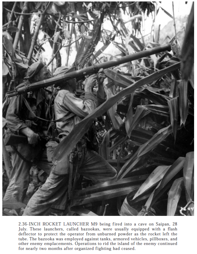
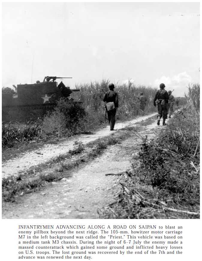
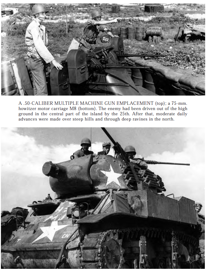
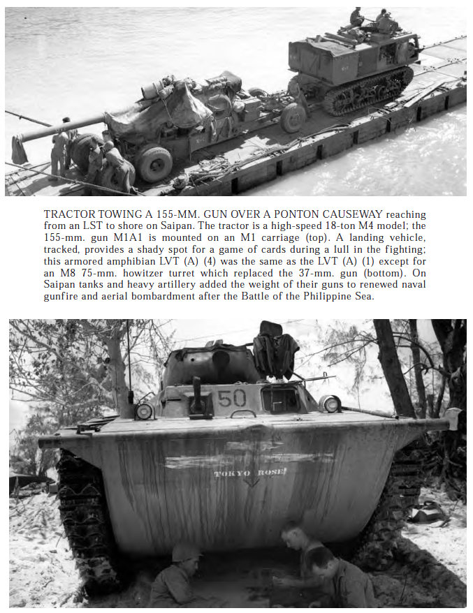
Mariana Island, Saipan
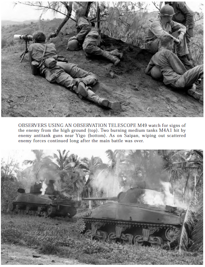
A picture of the rare Japanese tank.The most interesting interesting thing about this pair is the Shermans are captioned incorrectly. These Shermans are both M4 composite hulls, it’s possible the guy doing the captions didn’t know the existed.Bazooka in use against the Japanese.M7 in use on Saipan by the US Armyother armored vehicles that saw use in the PTOMore pics from Saipan, the battle there saw a lot of Sherman use, and deserves a post of it’s own.
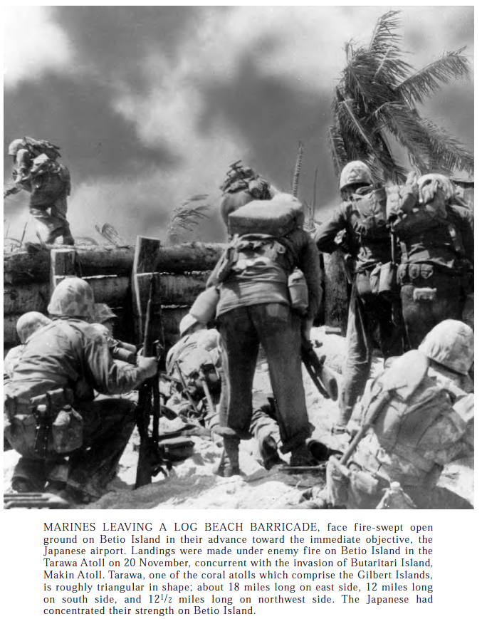
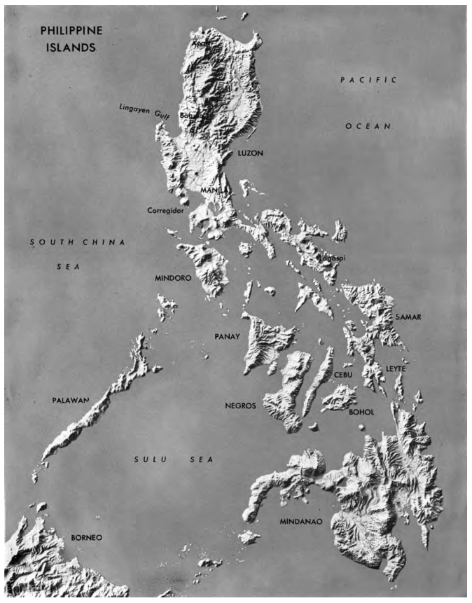
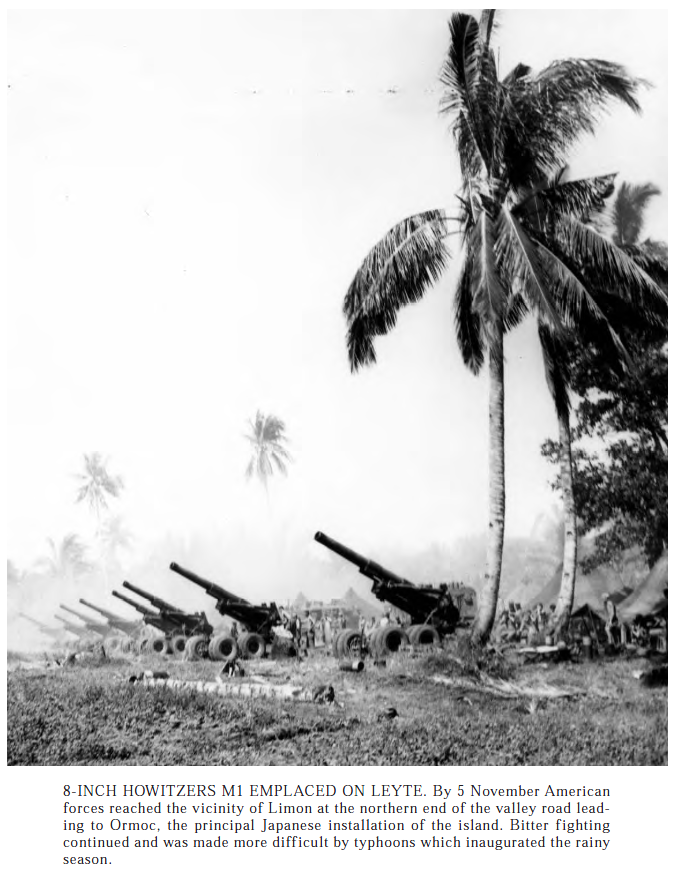
The infamous Tarawa beach barricade that prevented Shermans from moving inland.The battle of Peleliu was a meat grinder that ate up Maries.A bad map of a the Philippines, that we did return to, because General MacArthur would have it no other way, and it made sense. The Japanese did not go easy and committed mass atrocities against the people of the Philippines.The US Army was probably the best user of Artillery in the war.
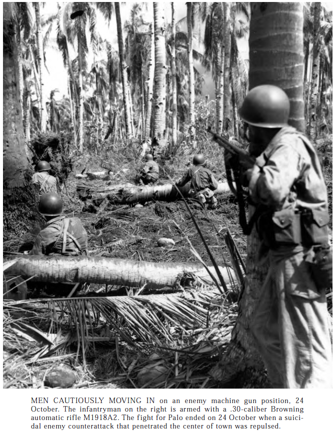
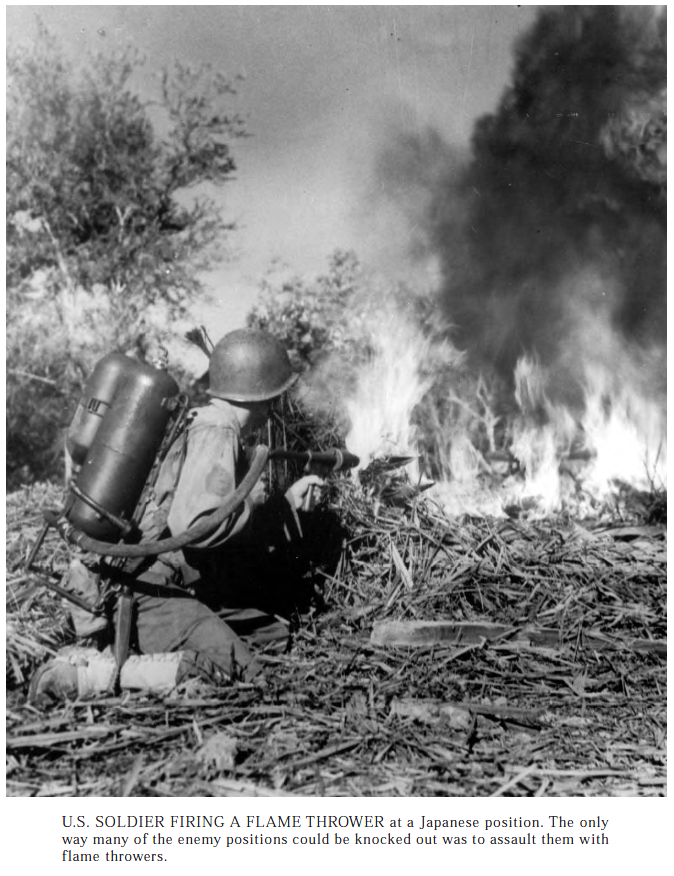
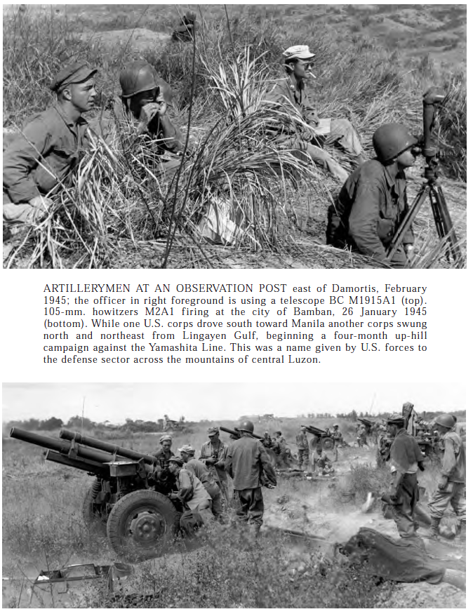
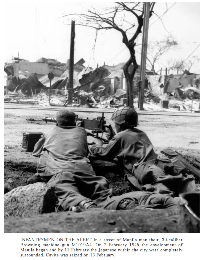
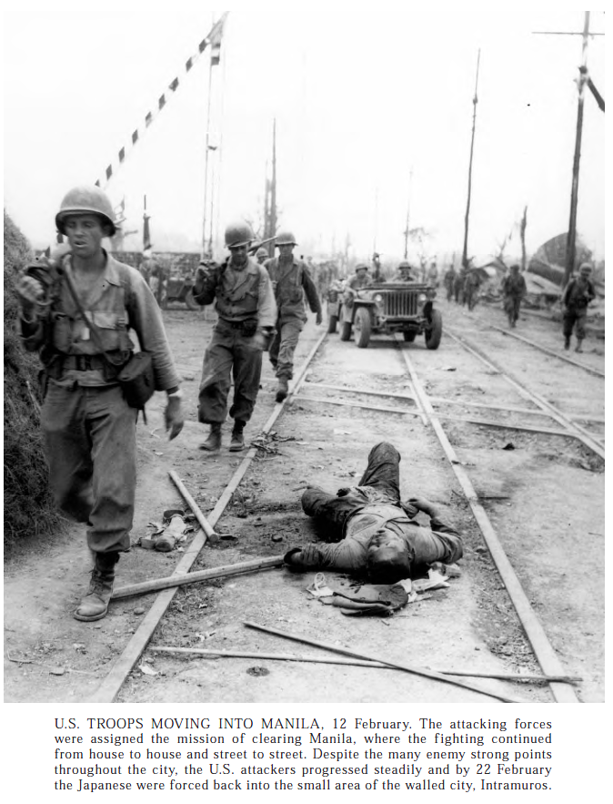
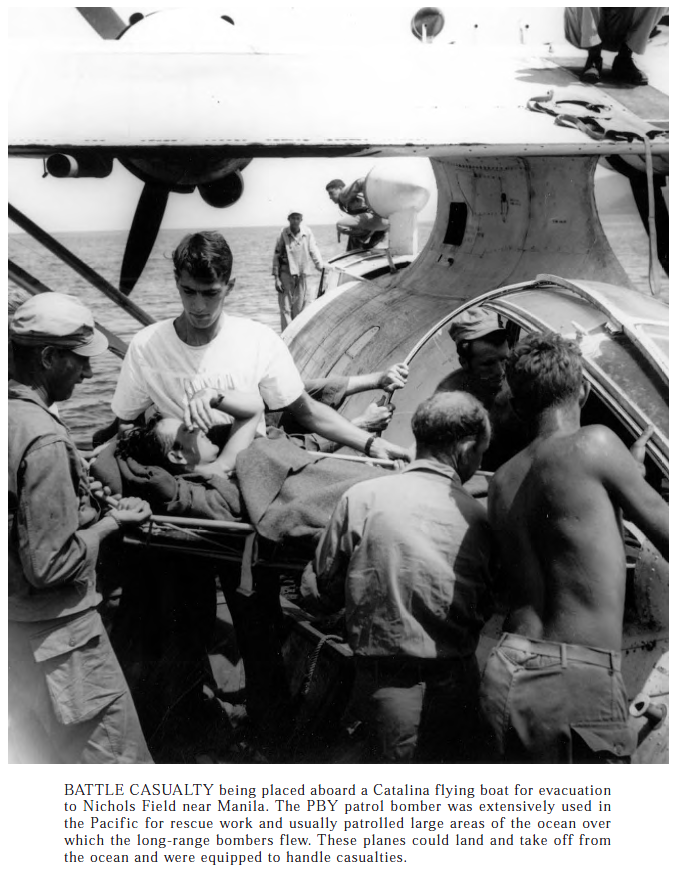
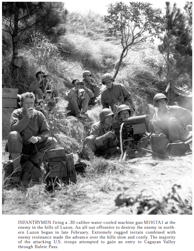
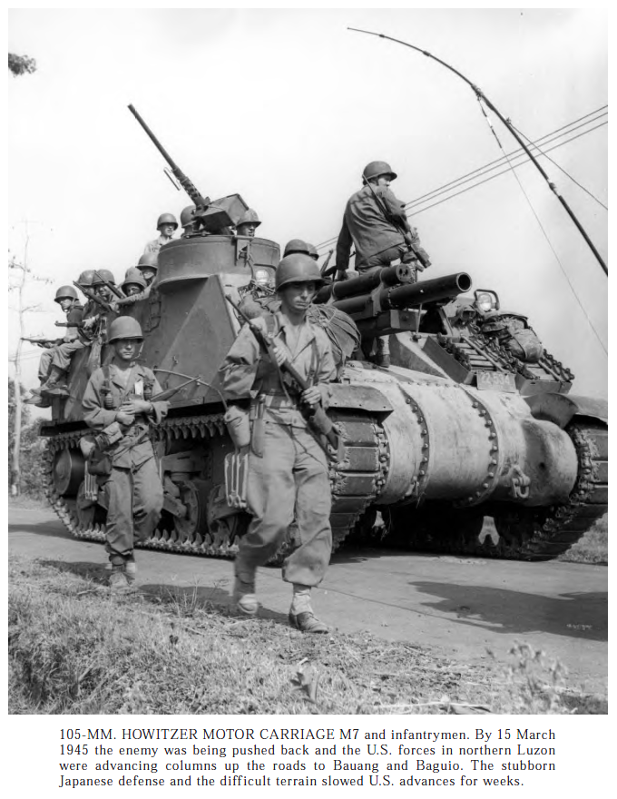
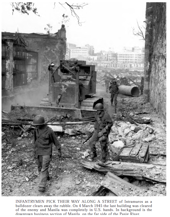
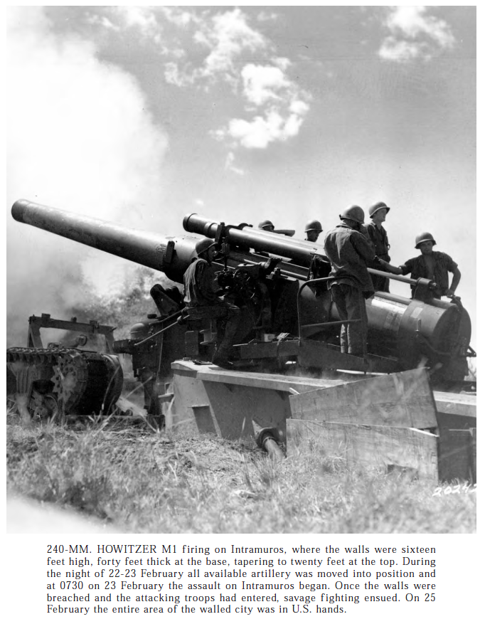
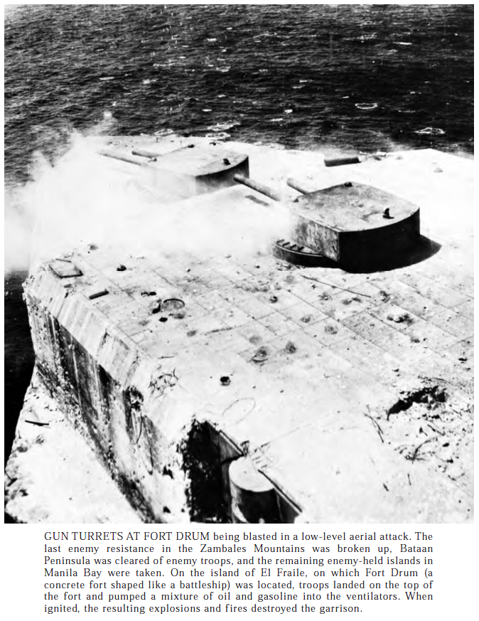
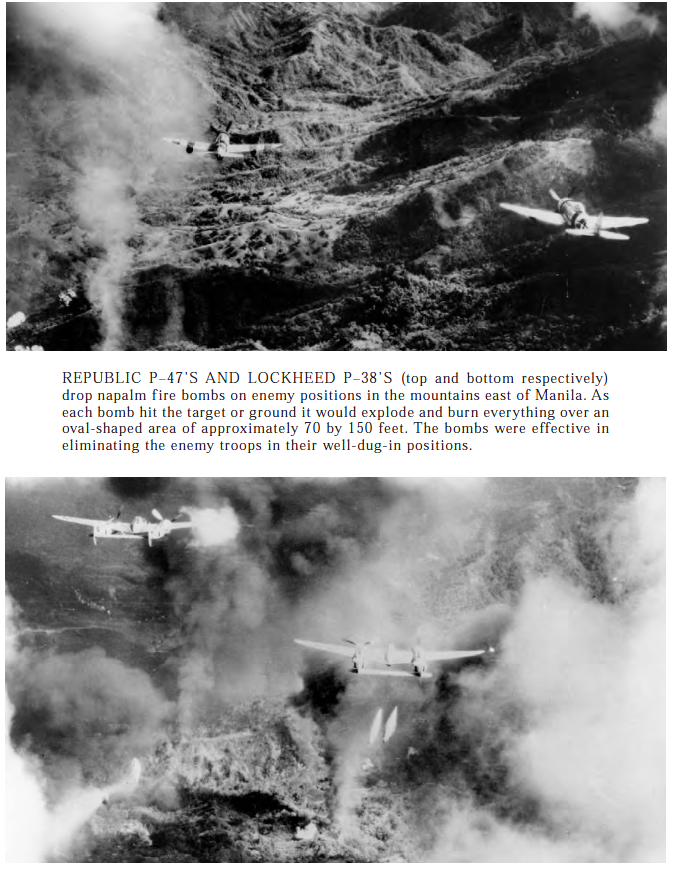
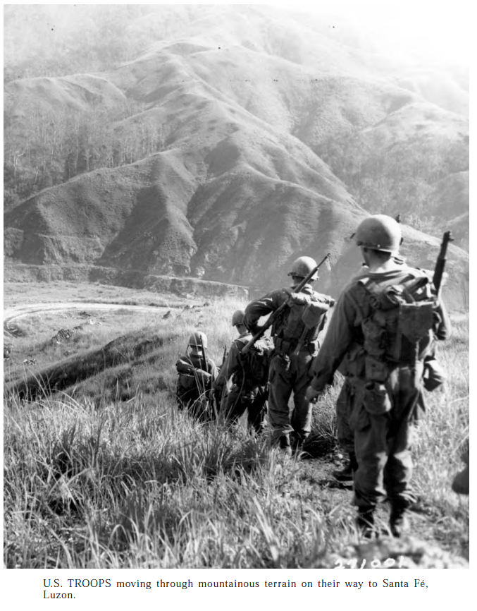
The liberating of the Philippines was a long brutal battle, and the Sherman played a part any time they could get to the fight, and since the terrain varied a huge amount, it was a lot.The flamethrower was always useful against stubborn japanese resistance.Artillery being done right.The weapons of John Moses Browning played a huge role weapons used by the US Army and Marine Corps.No one was concerned with Japanese corpses, a sign of just how highly they were held in contemp.The PBY was such a interesting and cool airplane, even as slow as it was, it saw use in patrolling, recon, and search and rescue the whole war. Few still fly today, the survivors were worked to death for the most part.Another one of Browning’s guns.a mobile 105 is always useful.We not only beat the Japanese, we helped clean up after them, and they left a hell of a mess.Look at the size of that thing, think of the logistical tail to keep that thing shooting, but the US Army did it with style.Did you know in Manila Bay had a huge two turret concrete battleship made by the US? Further, this Fort held out for an awful long time, before surrendering to the japanese, and they destroyed the weaponry, since just about all of it was still working? Me neither, Fort Drum is pretty damn interesting though. What’s left of it is still out there, rusting and being scavenged away.By this point in the war, the US and the Allies had a bunch of very capable aircraft, and the Japanese had not kept up in aircraft technology or in pilot training. The environment, and distance was a far bigger killer of US pilots than the Japanese.Another M7. Being a lot lighter than a Sherman but with the same drivetrain, the M7 was pretty handy off road.Not much Jungle here…This looks more like light forest.Another impressive US Artillery piece.
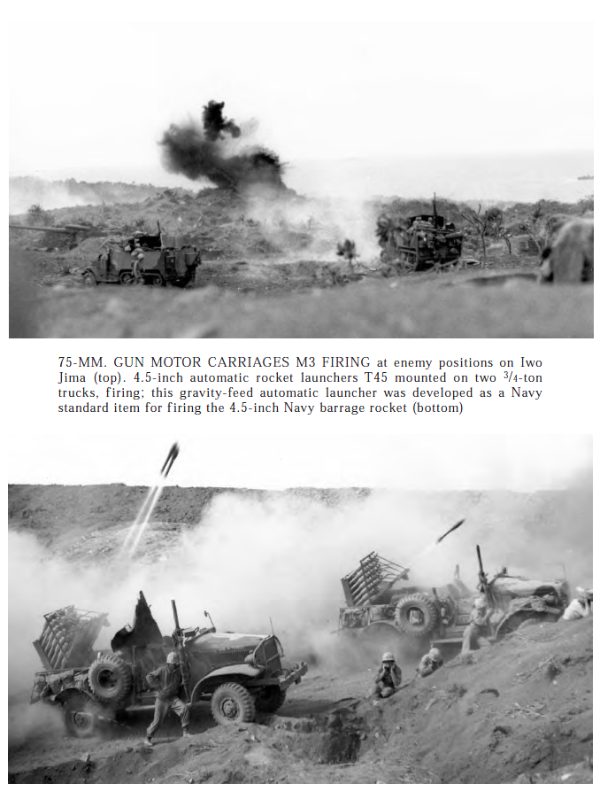
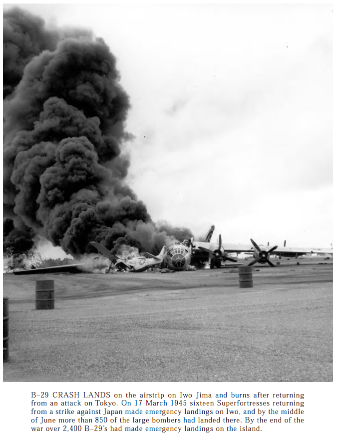
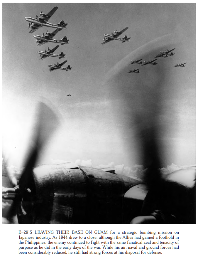
LST has a lot of stuff on deck, this ships were not fun in bad weather, a not uncommon occurrence in the Pacific.Iwo Jima is one of the most well know battles of the Pacific.The B-29 has a very interesting history, and it had a very troubled introduction. Books have been written on it, check em out.
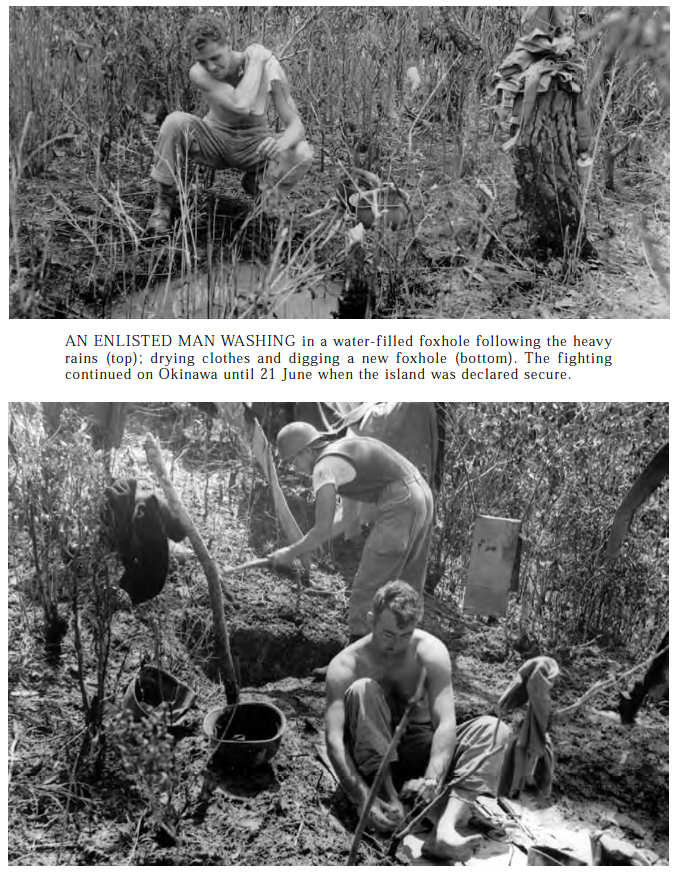
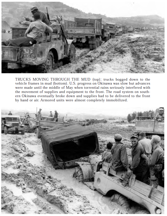
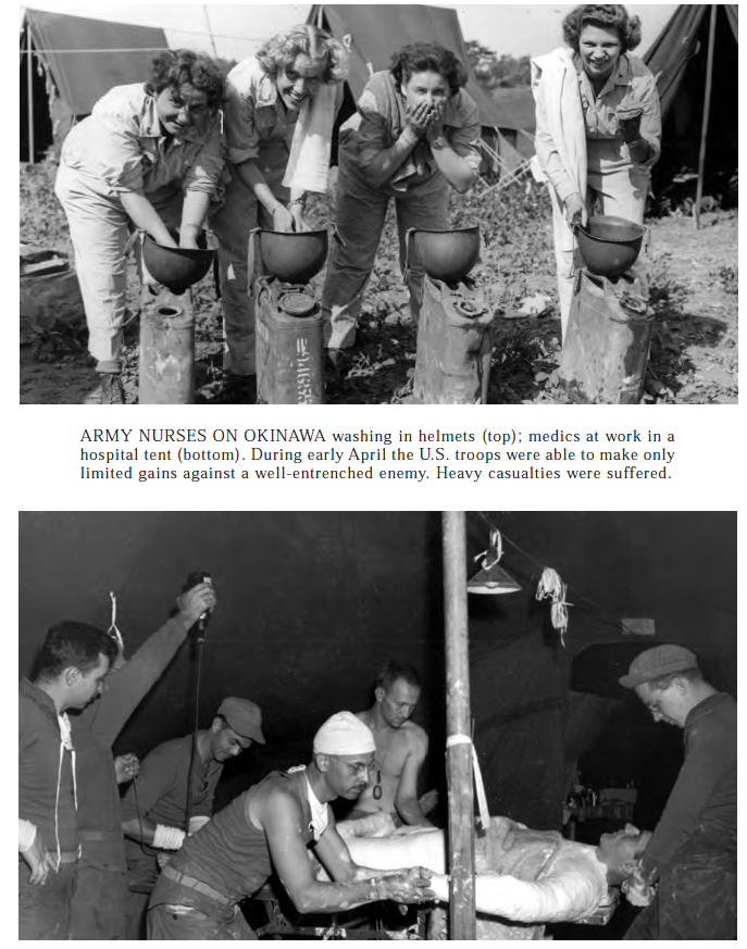
Those big engines were the cause of many of the B-29s problems, they would be resolved, and the motor would eventually become a reliable workhorse.Okinawa was a meat grinder that ate up Army and Marines, in very large numbers, the kind of numbers that made the prospect of invading mainland Japan, a very scary and bloody prospect.Epic mud was just one of the problems on Okinawa.Yeah, Army nurses went with the Army, you’re great grandmother could have been with the Army on Okinawa. These nurses had a safe space too, they dug it with a little shovel behind their tent, it was called a foxhole.
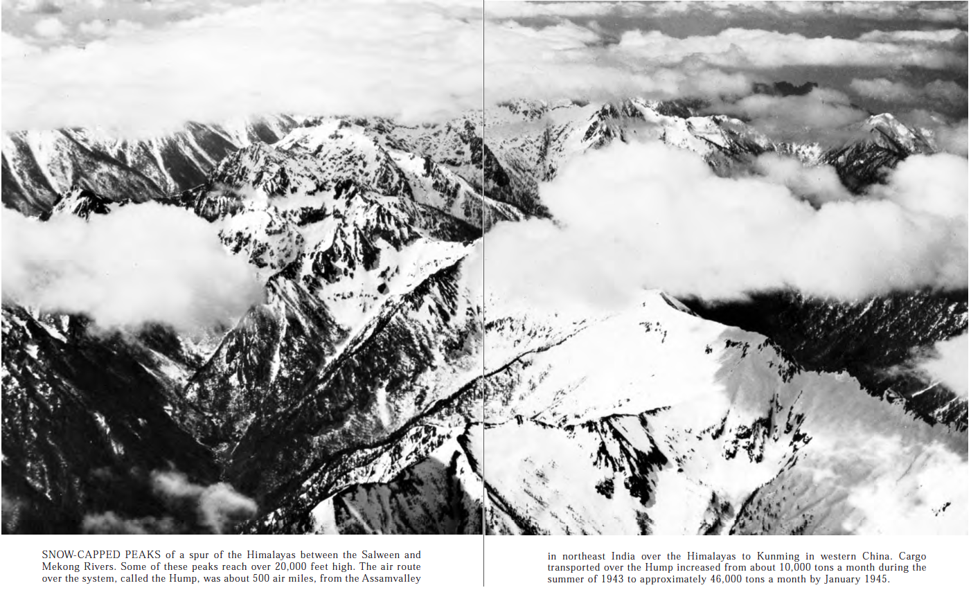
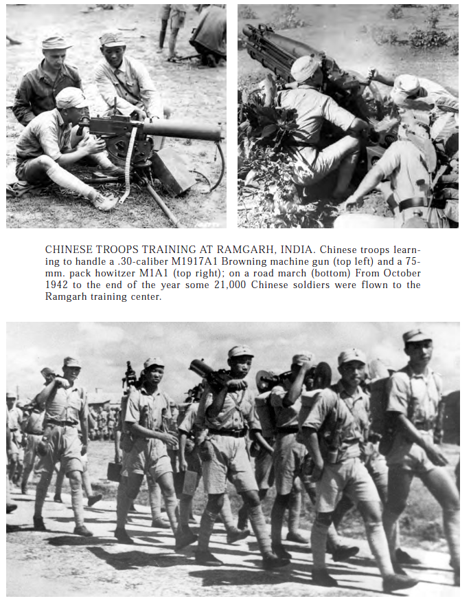
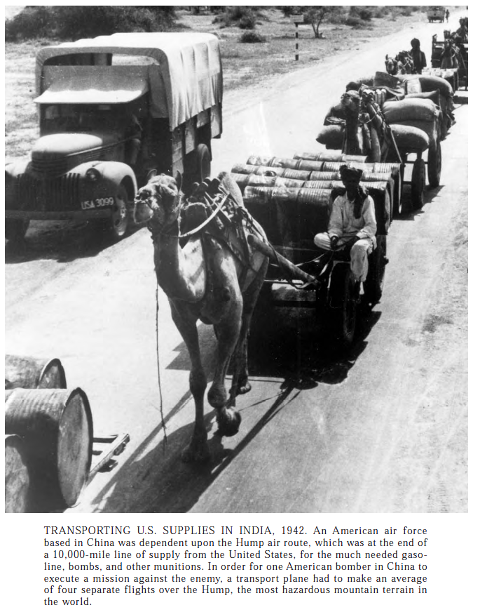
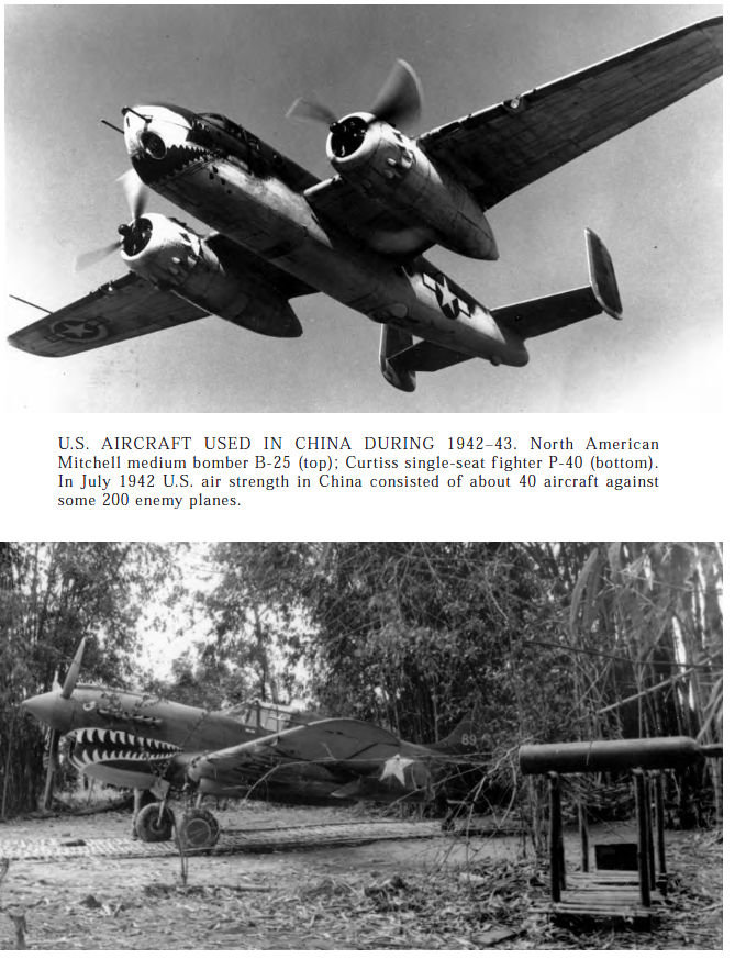
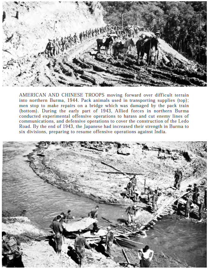
CBI
China, Burma, and India, the CBI, the PTO was a secondary theatre, the CBI was a nearly forgotten one and still is.
There was more than one set of Chinese troops, there were Nationalist, Communists, and bandits!
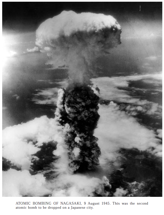
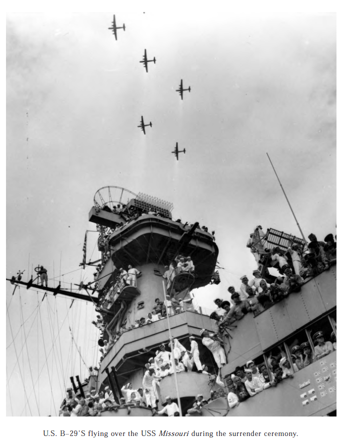
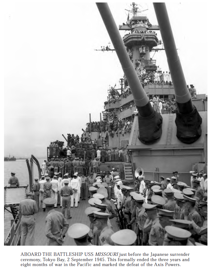
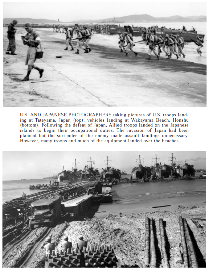
Some people consider the use of these weapons a war crime or and atrocity, and they were not. The two atomic bombs dropped were a mercy weapons, sure they killed a lot of people, but the fire bombing killed more. The very successful campaign to isolate the island of Japan from the world was in place and working, and the US Sub Force were like hungry sharks looking for anything floating to sink. An invasion of the mainland would have killed more on both sides, starving them out even more, so Truman made the call and ended the war.Steel justice, floating in Tokyo Harbor, you can still see the plaque were they signed the surrender papers, on this very ship, in Hawaii, moored in Pearl Harbor, now a majestic museum ship.Another shot of the Mighty Mo, these ships contained technology that would have had the sailor of the Nazi Navy believing in the supernatural, it was so far ahead of their naval tech.Once they Japanese tossed in the towel, there was very little resistance and very few problems. MacArthur would go on to rule the Island for a little while, shielding the Emperor from trail as a war criminal, but that’s another story.
At nearly 3000 words for captions, this thing got way out of hand, thanks for reading.
1 thought on “#66 Sherman Tanks of the US Army Official History books: This time the Pacific!”


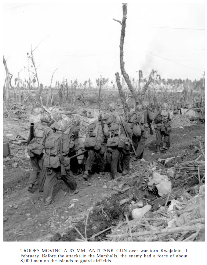


The Tank Battalion on Kwaj was the 767th .